
Fire spreads to 3 houses in Avondale
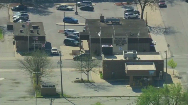
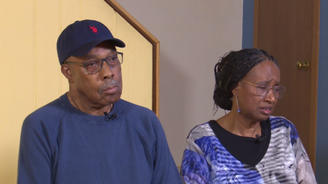
A man and his 83-year-old mother lost more than 50 years of memories and precious items as the fire ravaged their home.
Watch CBS News
Breaking News, First Alert Weather, Exclusive Investigations & Community Journalism
A man and his 83-year-old mother lost more than 50 years of memories and precious items as the fire ravaged their home.
The investigation comes amid months of controversy and divisiveness swirling in the south suburb.
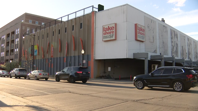
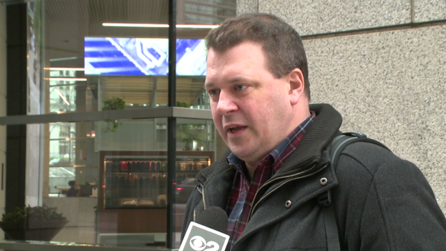
Lakeshore Sport & Fitness said a member had her bag stolen last week from the pool deck. Her keys were then used to steal her car in the parking lot.
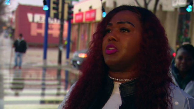
City data show crime is down in the Austin community since Sandie Norman set up her ministry at Madison and Central.
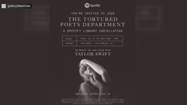
Amid the release of Taylor Swift's new album "The Tortured Poets Department," Chicago's Showbiz Shelly says, "there's a lot to unpack."
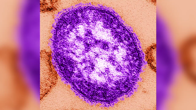
The city's measles dashboard said a total of 63 measles cases have been confirmed in Chicago this year, with one new case this week.

Spencer Turnbull carried a no-hit bid into the seventh inning, Alex Bohm hit a pair of three-run homers and the Philadelphia Phillies beat the Chicago White Sox 7-0 to extend their winning streak to four.
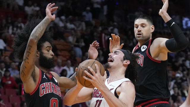
Tyler Herro scored 24 points and was an assist shy of a triple-double, rookie Jaime Jaquez Jr. added 21 points and the Miami Heat grabbed the last spot in the Eastern Conference playoffs, running away from the Chicago Bulls 112-91 in a play-in tournament elimination game.
Breaking News, First Alert Weather, Exclusive Investigations & Community Journalism
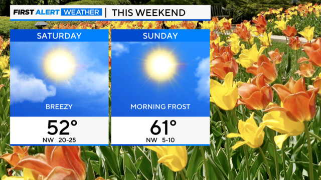
Clear skies and lighter winds will allow temperatures to dip to near-freezing in Aurora, De Kalb, and McHenry.

CBS 2 News Chicago's weather forecast model — First Alert — helps digital users and traditional television viewers stay on top of Chicago's dynamic weather.
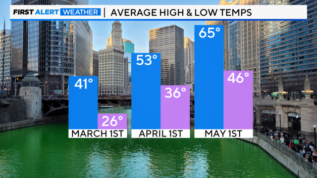
The emergence of greenery and blossoms is underway soon as El Niño fades away, and we transition to a neutral weather pattern.
Anthony Robinson's attorney said his previous defense lawyer failed to present evidence that showed it was physically impossible for him to be the shooter.

The village board is working on a resolution to hire Lightfoot, a former federal prosecutor before her lone term as Chicago's mayor, to investigate claims Henyard has been misusing public funds.
DCFS Director Heidi Mueller was asked Thursday why some kids in the system are being held in psychiatric hospitals longer than medically necessary.
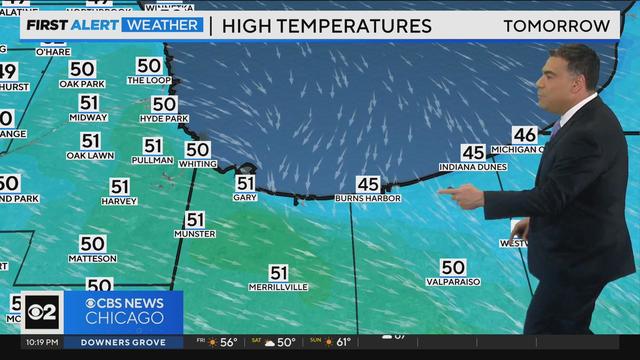
CBS 2 Chief Meteorologist Albert Ramon has your 10 p.m. First Alert Weather forecast for Friday, April 19, 2024.
No matter the weather, the Sandie Norman Ministry sets up at Madison Street and Central Avenue every Friday for prayer, fellowship, and good, hot, homemade food. CBS 2's Jim Williams introduces us to Norman and the impact of her work in this week's Eye on Chicago.
Lakeshore Sport & Fitness said a member had her bag stolen last week from the pool deck. Her keys were used to steal her car in the parking lot, and break into a home. CBS 2's Charlie De Mar reports.
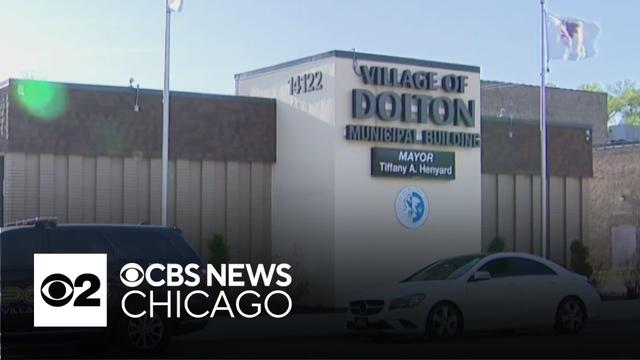
The FBI searched the village hall in a court-authorized law enforcement action. As CBS 2's Jermont Terry reports, it is not clear what the agents were investigating.

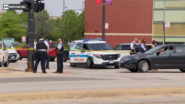
The family in the house on Christiana Avenue in Avondale, where the fire was believed to have started, said they lost everything. CBS 2's Marybel Gonzalez reports.
Spencer Turnbull carried a no-hit bid into the seventh inning, Alex Bohm hit a pair of three-run homers and the Philadelphia Phillies beat the Chicago White Sox 7-0 to extend their winning streak to four.
Tyler Herro scored 24 points and was an assist shy of a triple-double, rookie Jaime Jaquez Jr. added 21 points and the Miami Heat grabbed the last spot in the Eastern Conference playoffs, running away from the Chicago Bulls 112-91 in a play-in tournament elimination game.
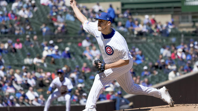
Jameson Taillon had a solid first start, Nico Hoerner doubled twice and the Cubs rolled past the Miami Marlins 8-3.
City data show crime is down in the Austin community since Sandie Norman set up her ministry at Madison and Central.
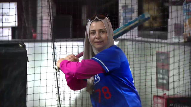
ChiTown Muslimah Athletics is a women's Muslim athletics group for women 23 and over.
His abrupt departure left many questioning what happened and why so suddenly.
Overall, the mayor's borrowing plan would cost the city $2.4 billion through 2061.
The investigation comes amid months of controversy and divisiveness swirling in the south suburb.
The council also approved $48 million in grant money from the state and federal government, much of which will be used to pay outstanding debt the city owes for staffing and shelter costs.
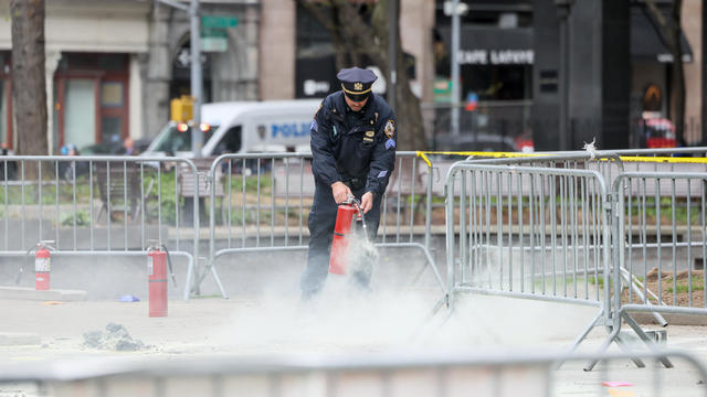
A person self-immolated at a park across from the courthouse where former President Donald Trump's New York criminal trial is taking place.

The jury selection process in former President Donald Trump's New York trial came to a close on Friday, part of a flurry of activity that marked the end of a dizzying first week.
The family didn't get their cut of the estate sale, not hearing back from the salesman until CBS 2 got involved.
The Better Business Bureau warns that anyone buying an event ticket should watch out for fake ticket scams.

Financial records show Paul Croft and J.D. Frost raised about $30 million for a hydrogen plant that was supposed to be, at one point, in Indiana. It never existed, an attorney says.

Anyone with these sausages in their refrigerators should throw them away or return them to the store.
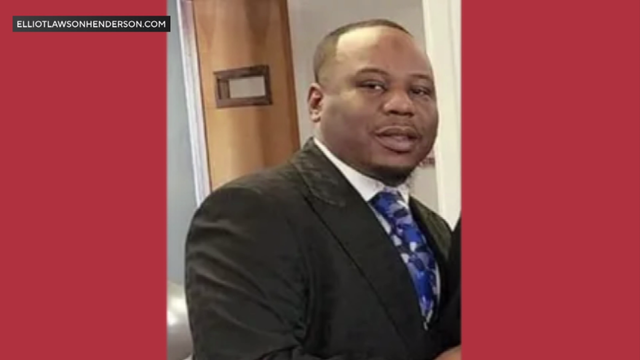
Elliott Henderson, of south suburban Glenwood, is featured on a website, a petition, and Facebook and Instagram pages -- all dedicated to warning others about his travel deals.
The city's measles dashboard said a total of 63 measles cases have been confirmed in Chicago this year, with one new case this week.

The department said anyone who visited the Sam's Club at 9400 S. Western Ave. in Evergreen Park one day last week may have been exposed to someone with measles.

Health officials are warning consumers not to consume Infinite Herbs basil sold at some Trader Joe's and Dierberg's stores after 12 people were sickened.
Officials said there was no known link between this case and the recent outbreak of measles at a migrant shelter in Chicago.
Health department officials said the case does not appear to be linked to new migrant arrival shelters in Chicago, and the source of infection is unknown.

Café Selmarie, 4721 N. Lincoln Ave., first announced its plans to close in September. Owner Birgit Kobayashi is set to retire.
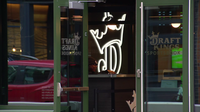
Right now, Illinois sports books pay 15% tax on their revenue. But Gov. JB Pritzker's latest budget proposal would spike the tax to 35%.

Currently, a pair of two-story vintage buildings occupy the space.
Quinn has filed an ordinance with the Chicago city clerk that would ask the City Council to put a referendum on the November ballot allowing voters to decide if their tax dollars should support new stadiums.
The Lincoln Square standby, at 4721 N. Lincoln Ave., first announced its plans to close in September.

The singer was found deceased at her home, a representative said.

Anticipation was growing at a fever pitch before Taylor Swift's latest album, "The Tortured Poets Department," dropped at midnight EDT. But it turned out it's actually a double album.
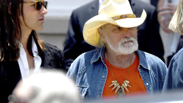
Guitar legend Dickey Betts, who co-founded the Allman Brothers Band and wrote their biggest hit, "Ramblin' Man," has died.

Colbert lived in Chicago for 11 years, performing and "cutting his comedy teeth" at the legendary Second City and attending Northwestern University. His show will broadcast from Chicago's storied Auditorium Theater Aug. 19-22 on CBS.
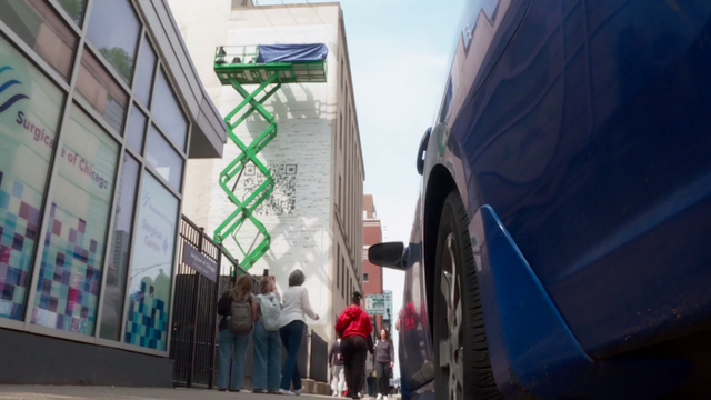
The mural was unveiled on the side of the building at the southeast corner the Chicago Medical Society building at Grand Avenue Dearborn Street.
CBS 2 Chief Meteorologist Albert Ramon has your 10 p.m. First Alert Weather forecast for Friday, April 19, 2024.
No matter the weather, the Sandie Norman Ministry sets up at Madison Street and Central Avenue every Friday for prayer, fellowship, and good, hot, homemade food. CBS 2's Jim Williams introduces us to Norman and the impact of her work in this week's Eye on Chicago.
Lakeshore Sport & Fitness said a member had her bag stolen last week from the pool deck. Her keys were used to steal her car in the parking lot, and break into a home. CBS 2's Charlie De Mar reports.
The FBI searched the village hall in a court-authorized law enforcement action. As CBS 2's Jermont Terry reports, it is not clear what the agents were investigating.
The family in the house on Christiana Avenue in Avondale, where the fire was believed to have started, said they lost everything. CBS 2's Marybel Gonzalez reports.
A man and his 83-year-old mother lost more than 50 years of memories and precious items as the fire ravaged their home.
The investigation comes amid months of controversy and divisiveness swirling in the south suburb.
Lakeshore Sport & Fitness said a member had her bag stolen last week from the pool deck. Her keys were then used to steal her car in the parking lot.
City data show crime is down in the Austin community since Sandie Norman set up her ministry at Madison and Central.
Amid the release of Taylor Swift's new album "The Tortured Poets Department," Chicago's Showbiz Shelly says, "there's a lot to unpack."
Anthony Robinson's attorney said his previous defense lawyer failed to present evidence that showed it was physically impossible for him to be the shooter.
The village board is working on a resolution to hire Lightfoot, a former federal prosecutor before her lone term as Chicago's mayor, to investigate claims Henyard has been misusing public funds.
DCFS Director Heidi Mueller was asked Thursday why some kids in the system are being held in psychiatric hospitals longer than medically necessary.
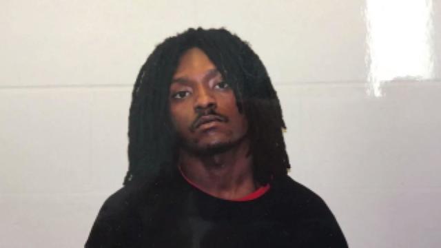
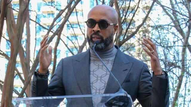
CBS 2 discovered the woman, Whitley Temple, was hired by the City of Chicago while awaiting trial.
Whitley Temple pleaded not guilty to the charges — and after nearly two years of delays, the case goes before a Cook County judge for trial on Monday.
Spencer Turnbull carried a no-hit bid into the seventh inning, Alex Bohm hit a pair of three-run homers and the Philadelphia Phillies beat the Chicago White Sox 7-0 to extend their winning streak to four.
Tyler Herro scored 24 points and was an assist shy of a triple-double, rookie Jaime Jaquez Jr. added 21 points and the Miami Heat grabbed the last spot in the Eastern Conference playoffs, running away from the Chicago Bulls 112-91 in a play-in tournament elimination game.
Jameson Taillon had a solid first start, Nico Hoerner doubled twice and the Cubs rolled past the Miami Marlins 8-3.
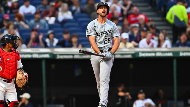
Their current winning percentage of .168 puts this year's squad on pace for a 27-135 record, which would far outpace the worst season in White Sox history.
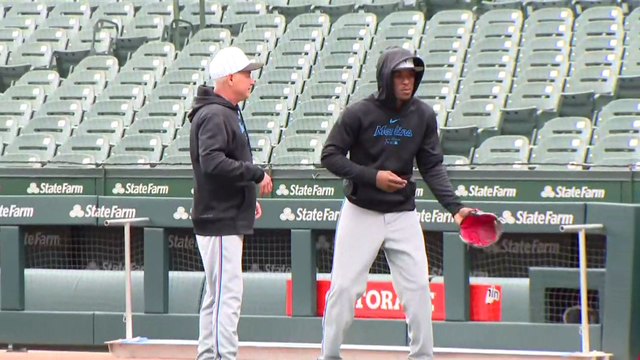
In February, Anderson agreed to a one-year contract with Miami worth $5 million.
Lakeshore Sport & Fitness said a member had her bag stolen last week from the pool deck. Her keys were then used to steal her car in the parking lot.
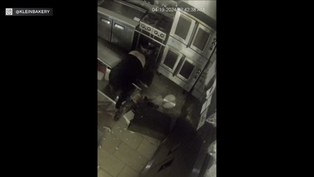
Police said the thief took property from the bakery and then left through the front door.

Two people were taken in serious to critical condition to Mt. Sinai Hospital for gunshot wounds.
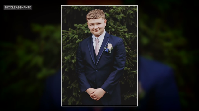
Damien Abenante-Villa's loved ones want to keep the crime in the spotlight to solve the murder.

Hundreds of teens had skipped school to meet in the Greenbelt, Maryland, park for a water gun fight, police said.